London Greenground Map by Helen Ilus
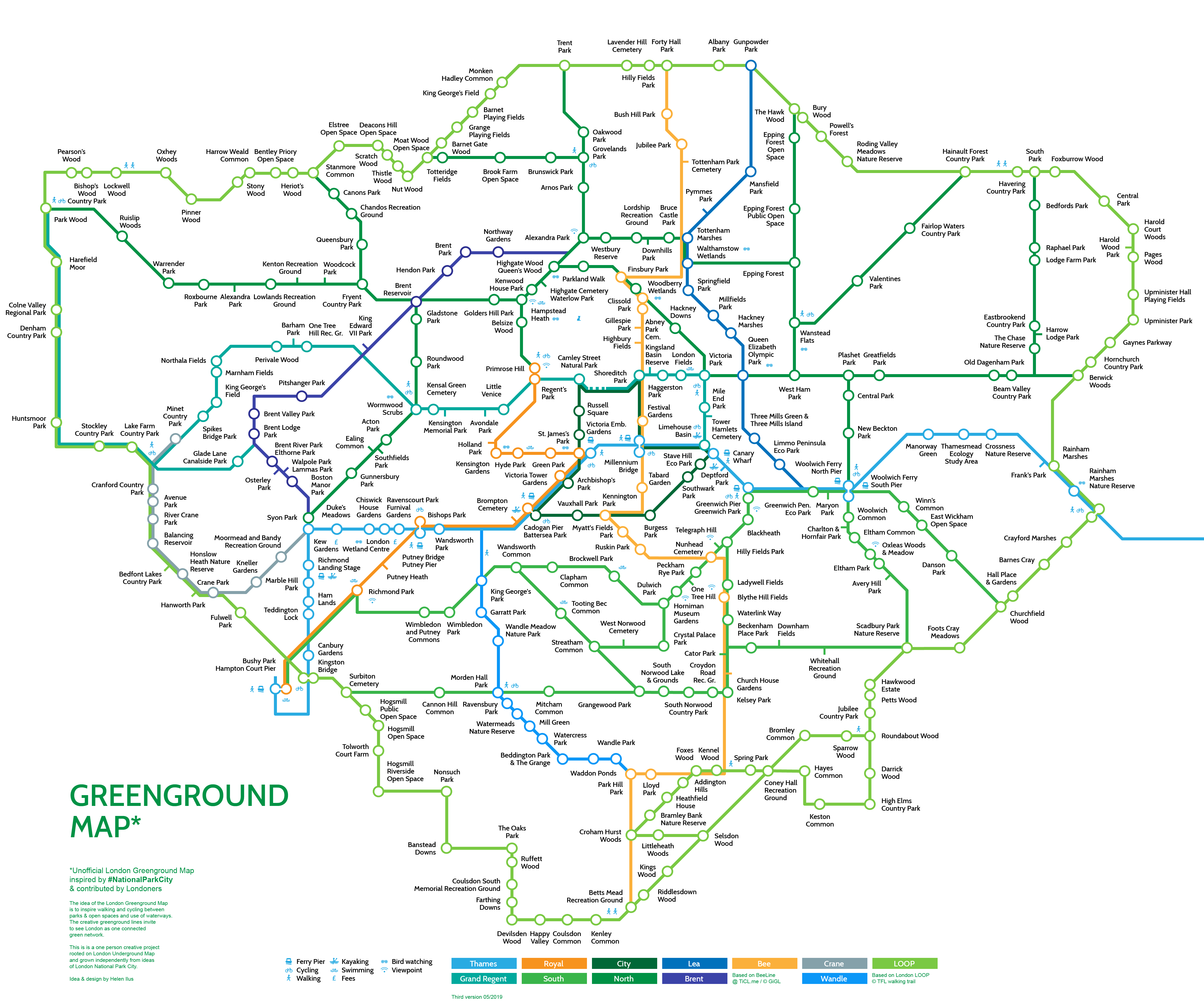
London Greenground Map is an independent project by graphic designer Helen Ilus to support the sustainable ideas of National Park City movement. The idea of the Greenground Map is to envision London as one walkable and cyclable network by connecting green spaces and waterways. The aim of the map is to inspire Londoners to be more active outdoors, spend time in nature and commute greenly in a legible way.
Inspired by iconic London Tube Map, the Greenground Map is an alternative view of the Beck’s diagram, where tube lines are replaced by creative green lines and stations by parks. The current version includes 12 green and blue lines and over 300 parks. The map also suggests viewpoints, kayaking and outdoor swimming places and birdwatching spots.
The map was made over two months in spring 2019 with suggestions and encouragement from National Park City supporters, Twitter audience and Londoners.
https://helenilus.com/2019/04/16/creative-park-connection-map/
https://helenilus.com/2019/04/29/park-connection-map-second-version/
(suggested parks: https://docs.google.com/spreadsheets/d/199cYOMLpDjpNKViV0REyPH8J5p-LdiDdEkamnOOf9bQ/edit#gid=0)
https://helenilus.com/2019/05/30/expanded-london-greenground-map/
Twitter @HelenIlus
-
CreditsHelen Ilus; National Park City supporters
-
Award
-
Categories
-
See more


